Energy towns
The «energy town» label is a record of achievement for local authorities, which set out and implement a sustainable joint energy policy. Energy towns promote renewable energies and environmentally compatible mobility and support the efficient use of resources.
Energy towns
Tags: Economy and Energy, Energy economy, Energy
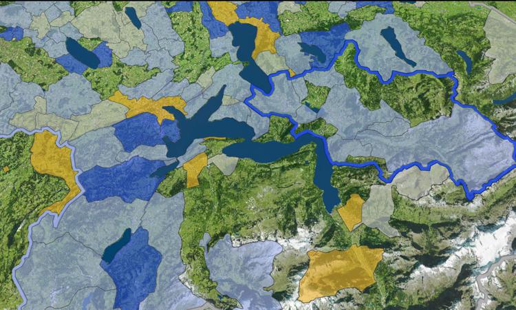
Spatial extent: Switzerland
Times: 1995, 2000, 2005, 2010, 2015, 2018, 2019, 2020, 2021
Map objects: Aadorf, Aarau, Aarburg, Adligenswil, Adliswil, Aesch (BL), Aeugst am Albis, Affeltrangen, Agglomération de Delémont (Région), Aigle, Aire-la-Ville, Airolo, Albulatal (Region), Alpnach, Altbüron, Altdorf (UR), Altendorf, Altstätten, Amriswil, Andermatt, Anières, Appenzellerland über dem Bodensee (Region), Arbedo-Castione, Arbon, Ardon, Arlesheim, Arth, Attalens, Au (SG), Auw, Avenches, Avry, Ayent, Baar, Bad Zurzach, Baden, Bagnes, Balgach, Ballwil, Basel, Bätterkinden, Beckenried, Bellevue, Bellinzona, Belmont-Broye, Benken (ZH), Berg (TG), Bergdietikon, Bern, Berneck, Bernex, Besenbüren, Bettingen, Bettwiesen, Bex, Bezirk Schwyz, Biel/Bienne, Bilten, Bioggio, Birsfelden, Bischofszell, Bitsch, Blonay, Bolligen, Bonaduz, Bottmingen, Bremgarten bei Bern, Brig-Glis, Broc, Brugg, Brügg, Bubikon, Buchs (AG), Buchs (SG), Bülach, Bulle, Burgdorf, Bürglen (UR), Büron, Bussigny, Bütschwil-Ganterschwil, Cadempino, Cadenazzo, Canobbio, Carouge (GE), Cartigny, Caslano, Cevio, Cham, Chancy, Châtel-Saint-Denis, Chêne-Bourg, Chézard-Saint-Martin, Chiasso, Choulex, Chur, Coldrerio, Collina d’Oro, Collombey-Muraz, Confignon, Corminboeuf, Corsier (GE), Cossonay, Courgevaux, Crans-Montana (Region), Crissier, Croglio, Cugnasco-Gerra, Dachsen, Dagmersellen, Dalakoop (Region), Davos, Delémont, Diepoldsau, Diessenhofen, Dietikon, Dietlikon, Dinhard, Domat/Ems, Dornach, Dottikon, Döttingen, Dübendorf, Ebikon, Ecublens (VD), Egnach, Egolzwil, Eich, Eichberg, Einsiedeln, Elgg, Emmen, Engelberg, Ennetbaden, Entlebuch, Entlebuch (Region), Epalinges, Erlinsbach (AG), Erstfeld, Eschenbach (LU), Eschenbach (SG), Eschlikon, Estavayer, Ettingen, Evolène, Fällanden, Farvagny, Fehraltorf, Felsberg, Flawil, Flerden, Flums, Fontenais, Frauenfeld, Freienbach, Freienwil, Frenkendorf, Fribourg, Fully, Gachnang, Gaiserwald, Gambarogno, Gams, Genève, Gibloux, Gipf-Oberfrick, Giswil, Givisiez, Gland, Glarus, Gletterens, Goldach, Goms (Energieregion), Goms (Region), Gordola, Gossau (SG), Gossau (ZH), Grabs, Granges-Paccot, Grenchen, Greppen, Grimisuat, Hagenbuch, Haldenstein, Hauptwil-Gottshaus, Hausen am Albis, Hedingen, Heiden, Hérémence, Hergiswil (NW), Herisau, Herzogenbuchsee, Hochdorf, Hofstetten-Flüh, Hohenrain, Hombrechtikon, Horgen, Horw, Hünenberg, Igis, Ilanz/Glion, Illgau, Illnau-Effretikon, Interlaken, Itingen, Kaiseraugst, Kaltbrunn, Kerns, Kirchberg (SG), Klosters, Klosters-Serneus, Kloten, Knonau, Köniz, Kreuzlingen, Kriens, Küsnacht (ZH), Küssnacht (SZ), Küttigen, La Chaux-de-Fonds, La Punt-Chamues-ch, La Punt Chamues-ch, Lancy, Landquart, Langenthal, Lauerz, Laufen, Lausanne, Lausen, Lavigny, Le Grand-Saconnex, Le Locle, Le Mont-sur-Lausanne, Le Mouret, Lengnau (AG), Lengnau (BE), Lenzburg, Leuk, Leysin, Lichtensteig, Liestal, Lindau, Locarno, Lugano, Lumino, Lungern, Lupsingen, Lutry, Luzern, Lyss, Magden, Mägenwil, Maienfeld, Malans, Malters, Männedorf, Marbach (SG), Marly, Maroggia, Marsens, Marthalen, Martigny, Mauensee, Meggen, Meilen, Meiringen, Melano, Melchnau, Mels, Mendrisio, Menznau, Mettmenstetten, Meyrin, Minusio, Mönchaltorf, Mont-Noble, Monthey, Montreux, Moosseedorf, Mörel-Filet, Morges, Morschach, Mörschwil, Moutier, Mühlau, Münchenbuchsee, Münchenstein, Münsingen, Muotathal, Muri bei Bern, Murten, Muttenz, Näfels, Naters, Neftenbach, Nendaz, Neuchâtel, Neuhausen am Rheinfall, Neyruz (FR), Nidau, Niederhasli, Niederwil (AG), Noréaz, Nottwil, Novazzano, Nürensdorf, Nyon, Oberägeri, Oberkirch, Oberkulm, Oberland-Ost (Region), Oberriet (SG), Obersiggenthal, Obertoggenburg (Region), Oberwil (BL), Obfelden, Oensingen, Oftringen, Olten, Onex, Opfikon, Orbe, Ossingen, Ostermundigen, Parc Ela, Parco Nazionale del Locarnese, Payerne, Pfäffikon, Pfaffnau, Plan-les-Ouates, PNR Gruyère Pays-d’Enhaut (Région), Porrentruy, Prangins, Pratteln, Prez, Prilly, Pully, Rafz, Rain, Rapperswil-Jona, Rebstein, Regensdorf, Region Surses, Regione ABM, Reigoldswil, Reinach (BL), Renens (VD), Rhäzüns, Rheinau, Rheinfelden, Richterswil, Riddes, Ried-Brig, Riederalp, Riehen, Riggisberg, Risch, Roggliswil, Roggwil (TG), Rolle, Romanshorn, Romont (FR), Rorschach, Rorschacherberg, Rossens (FR), Rüschlikon, Russikon, Ruswil, Rüthi (SG), Rüti (ZH), Saas-Fee, Saas Fee, Sachseln, Saint-Aubin (FR), Saint-Martin (VS), Saint-Prex, Sainte-Croix, Samedan, Sant’Antonino, Sargans, Sarnen, Satigny, Sattel, Savièse, Saxon, Schaffhausen, Schenkon, Schlierbach, Schlieren, Schneisingen, Schwarzenberg, Schwarzenburg, Schwyz, Scuol, Selzach, Sementina, Sempach, Semsales, Sennwald, Sensebezirk (Region), Seon, Seuzach, Sevelen, Sierre, Sins, Sion, Sissach, Siviriez, Solothurn, Sonnenberge-Agarn-Turtmanntal (Region), Sorengo, Sorens, Speicher, Spiez, Spreitenbach, St. Gallen, St. Margrethen, St. Moritz, Stabio, Stalden (Gemeindeverbund), Stammertal (Gemeinde-Verbund), Stammertal (Region), Stammheim, Stans, Stansstad, Steckborn, Steffisburg, Stein (AG), Steinach, Steinerberg, Steinhausen, Suhr, Surbtal (Region), Sursee, Surselva (Region), Terre di Pedemonte, Teufen (AR), Thal, Thal (Region), Thalwil, Thayngen, Therwil, Thônex, Thun, Thusis, Triengen, Trogen, Trüllikon, Truttikon, Turbenthal, Turgi, Uetikon am See, Unterägeri, Unterbäch, Unterkulm, Untersiggenthal, Urnäsch, Urtenen-Schönbühl, Uster, Uznach, Uzwil, Val-de-Charmey, Val de Bagnes, Val Müstair, Vaz/Obervaz, Vechigen, Vernier, Versoix, Vétroz, Vevey, Vezia, Villars-sur-Glâne, Vilters-Wangs, Visp, Vitznau, Volketswil, Vuadens, Wädenswil, Walchwil, Wald (ZH), Waldkirch, Walenstadt, Wallisellen, Wartau, Wattwil, Wauwil, Weggis, Weinfelden, Widnau, Wil (SG), Wiler bei Utzenstorf, Willisau, Windisch, Winterthur, Wittenbach, Wohlen (AG), Wohlen bei Bern, Wölflinswil, Wollerau, Worb, Yverdon-les-Bains, Zeihen, Zell (ZH), Zermatt, Zofingen, Zollikofen, Zuchwil, Zug, Zumikon, Zürich, ZürichseeLinth (Region), Zweisimmen